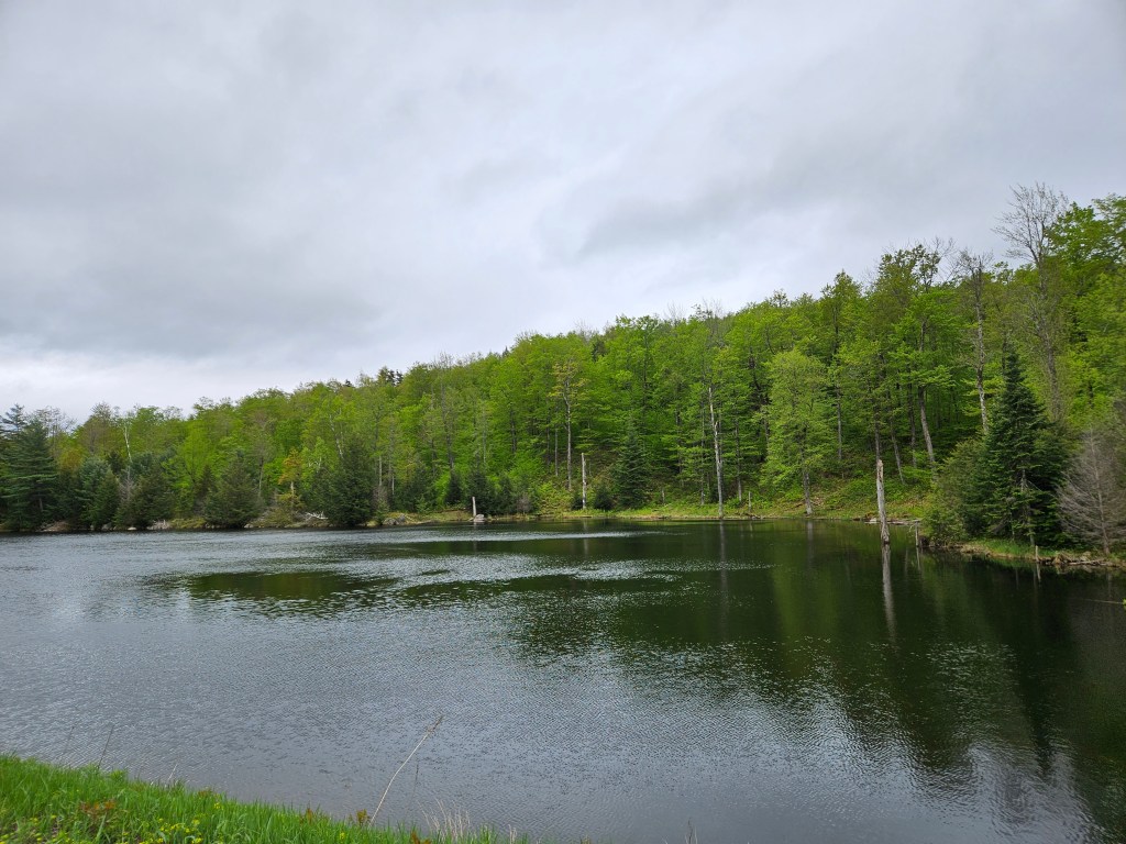
Bear Mountain State Park, NY
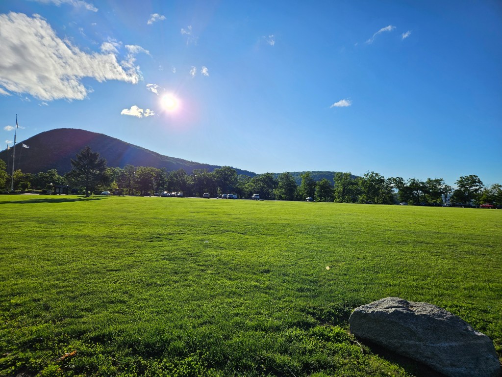
Bear Mountain State Park contains the lowest elevation on the Appalachian Trail, but is also one of the oldest sections as well.
I loved this small day hike on the trail. While most of the path was man made and lots some of the ‘back country’ feel I love about hiking, some of the views were amazing and I will not soon forget it.
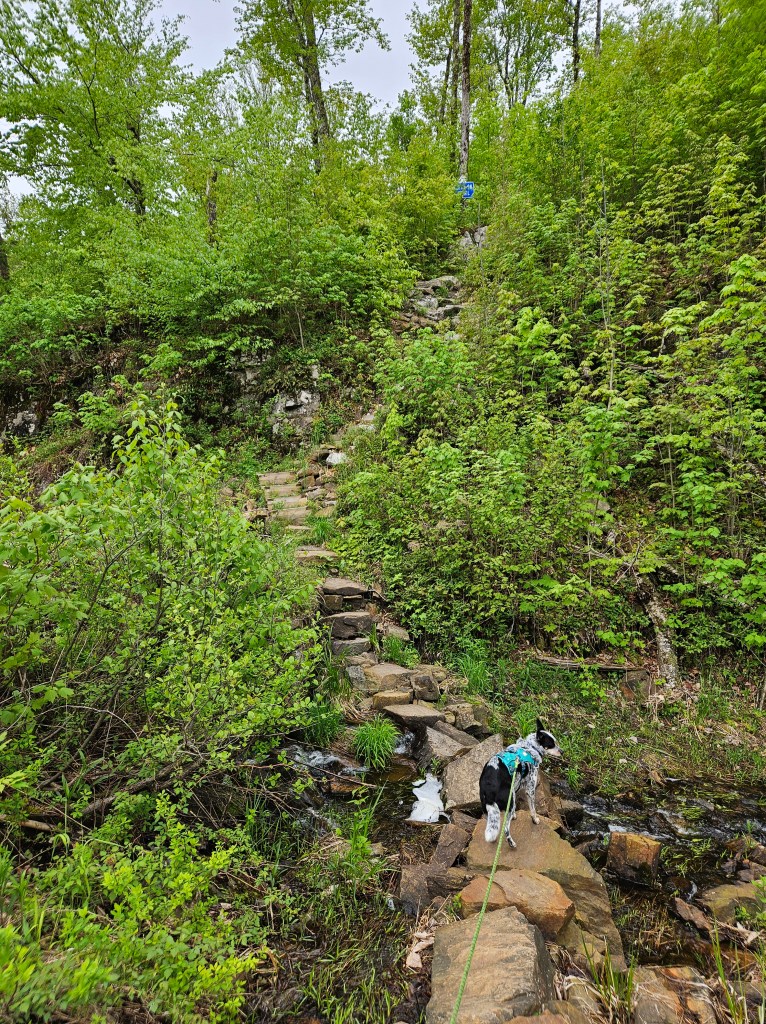
I started my hike early in the day around 630am. I made the obligatory pit-stop to the restrooms with actual plumbing (I have seen cleaner outhouses) and began hike just to the left of Lake Hessian. The beginning section was actually very informative, teaching anyone interested about how trail maintainers care for the path as well as the types of man-made structures used to protect the environment and help hikers through rougher sections of the trail.

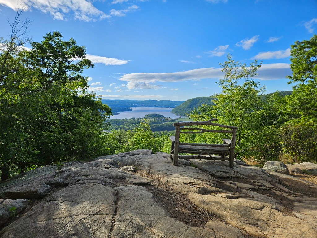
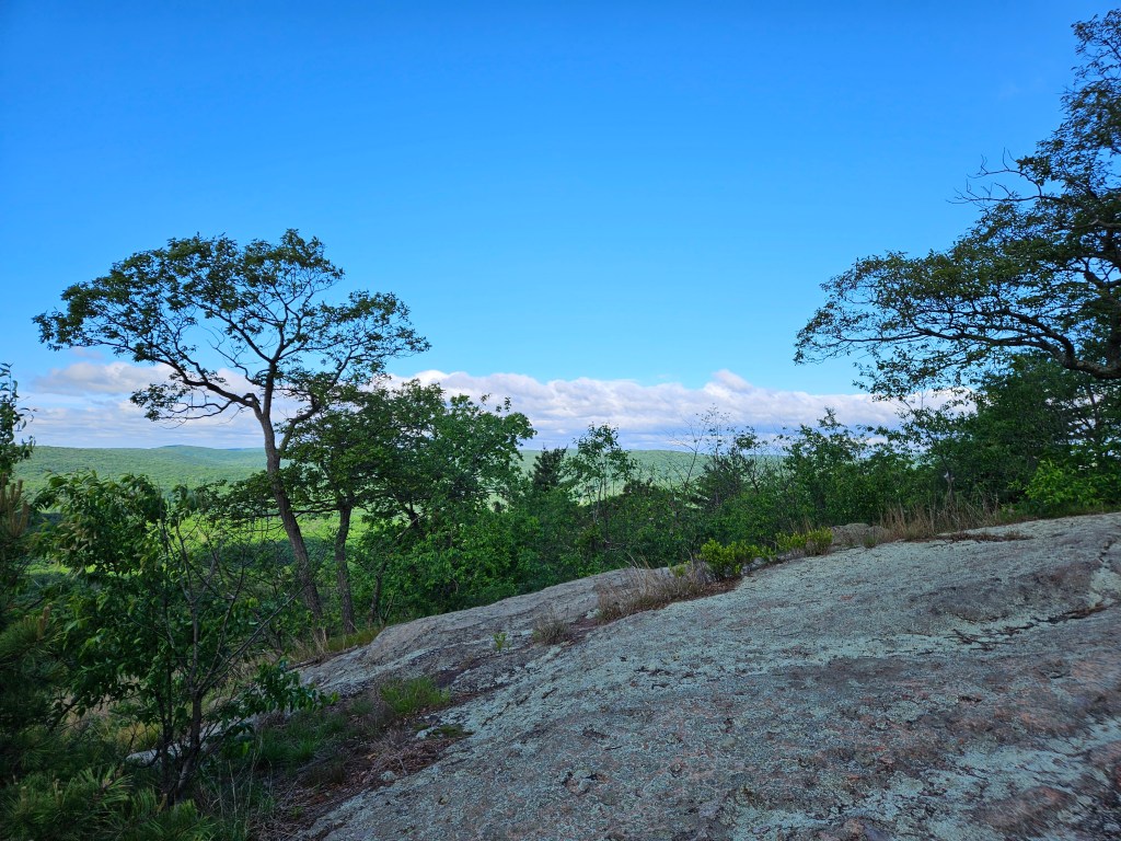
My ascent took me through some switchbacks and finally to the first view….of Bear Mountain Bridge.

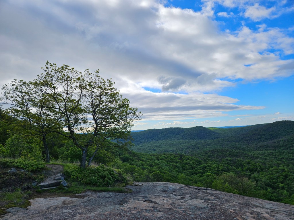
I continued onward and found the trail mild and easy to traverse, though stone steps abounded. Another nice overlook with a pretty bench greated me at the top of the climb before I moved onward to Perkins Memorial.
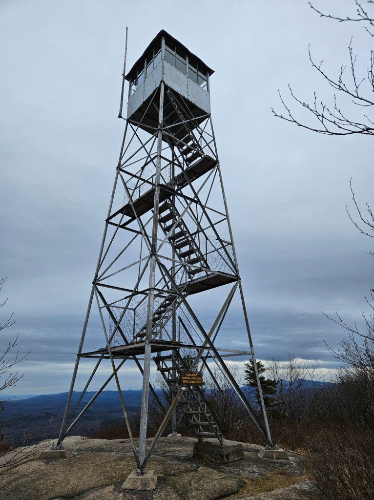
Perkins Memorial was closed when I got to the tower, but a very nice Ranger unlocked the door for me…after asking me to let him know if there were any snakes or bears up at the top!

I was VERY happy to reach and explore the tower before the hoard of tourists arrived for the day (as I found out on my way back to my car). There is a lot of history to read inside the tower, and I really enjoyed perusing the plaques. Trash cans and porta-potties are available near the memorial along with parking for tourists driving to see the attractions. While working on my Appalachian Trail Bucket List, I had picked up a Doritos bag, a plastic water bottle, 2 water bottle caps, and a snickers bar wrapper. On the way back to my car, the list was so long I cannot remember it all, though the inole of a shoe was memorable.
I continued on to Palisades Parkway and chose that as my turnaround point due to time and the vast amount of motorcycles racing down the street at terrifying speeds! I did not see any bears in this section, though a trail runner told me he has seen bears often past the memorial. The closest I got to wildlife was a house cat a couple brought with them.
Overall, I would rate the hike easy to mild. I had a few road crossings, almost got off trail once, and met some nice people along the way; it was a nice way to pass a Saturday morning. The park is well worth the visit and if you have time, but keep in mind a fee is charged for vehicle parking and is often crowded on summer weekends and holidays.
Until next time, stay safe out there and leave no trace!

Goodnow and Swede Mountains


May can be a risky time to hike in the Northeast; rain and mud abound, and a clear view at the top is never guaranteed. Tilly and I decided to tackle two more fire tower hikes before starting our plans for the Appalachian Trail this season.
Goodnow Mt. was a nice warmup to getting out trail legs in shape. We both enjoyed the quiet and green foliage surrounding us. We saw a few deer tracks and two nice ladies that were working on forest preservation.
While there was a bit of blow-down on the trail due to recent storms, most of it was surpassable. I will admit we had to detour off the very nice bog bridges at one section that had completely covered the trail with downed trees.
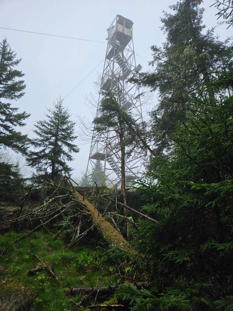
The top was so foggy I won’t even bother posting a picture of the ‘views” but a quaint little ranger cabin is located just below the fire tower and worth a peek.
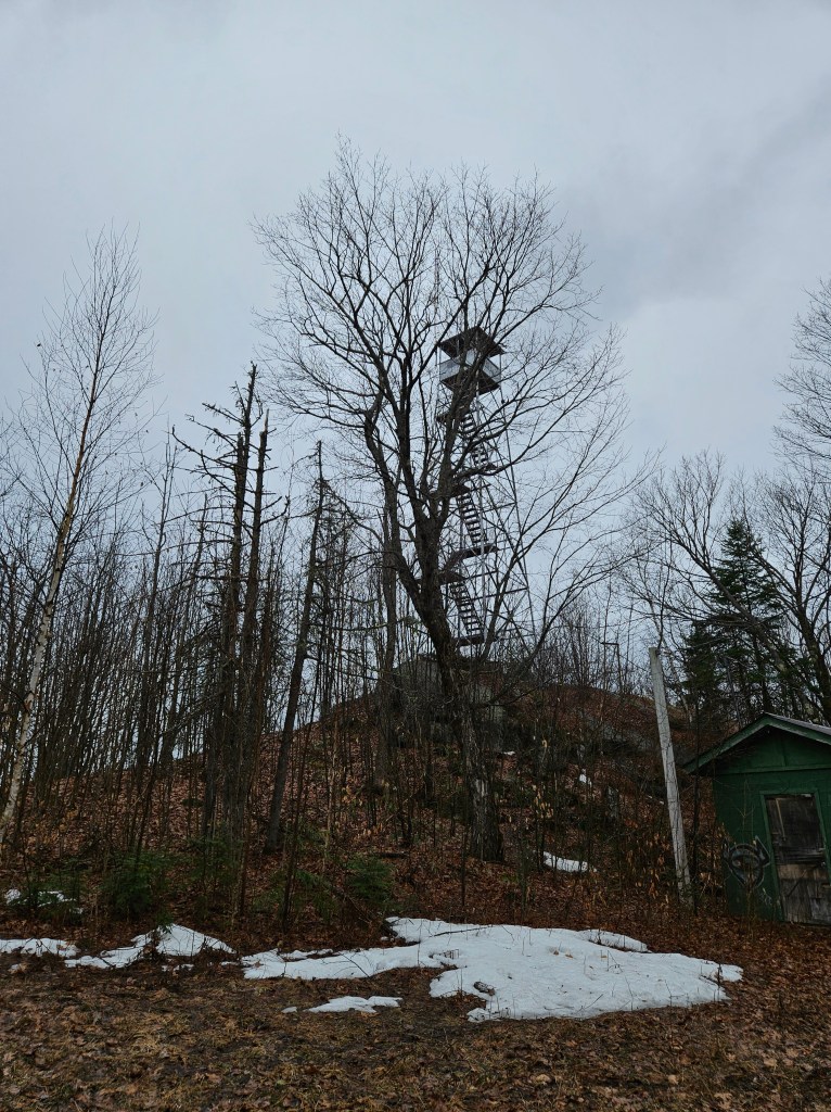
Next up, Tilly and I drove to Swede Tower as it was located not too far away and was listed on AllTrails as taking an average of 49 minutes.
I was surprised how much parking was dedicated to the small trail, on the side of a busy road. No toilets to be found, but I was pleased I had the place to myself.
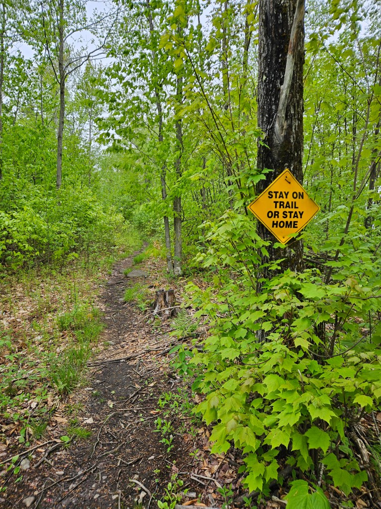
It really was a short hike, but far muddier than Goodnow Mt. This trail was clearly newer as well and single-file for almost the whole length. Overall, the trail stood out to me for all the passive-aggressive signage along the route that offered no views until the top.
There was only one section of the trail that made me pause to figure out which way to go. Close to the tower, the forest opens up and you come upon a T intersection. It looks like an ATV path the way the trail is humped in the middle. Turn right to go to the tower and remember to look for a left trail blaze when heading back down!
Once at the top the vista was still obscured by fog and rain. A lot of broken glass was at the base of the tower (I think from the broken placard containing information on the history of the tower).
I would hike Goodnow again, but Swede will probably never see my boots again unless I am helping a friend complete their ADK Fire Tower challenge.
The plan is to start logging some miles on the Appalachian Trail next! Until next time, stay safe out there and leave no trace!
Poke-O-Moonshine Mt.

After a snowy and very icy winter, spring hiking is in full swing! Tilly and I are developing our hiking legs for the push to tackle the Massachusetts section of the Appalachian Trail this year. Since I am also working on the Adirondack Fire Tower Challenge, I figured what better way to start training then checking off a few Fire Tower mountains.
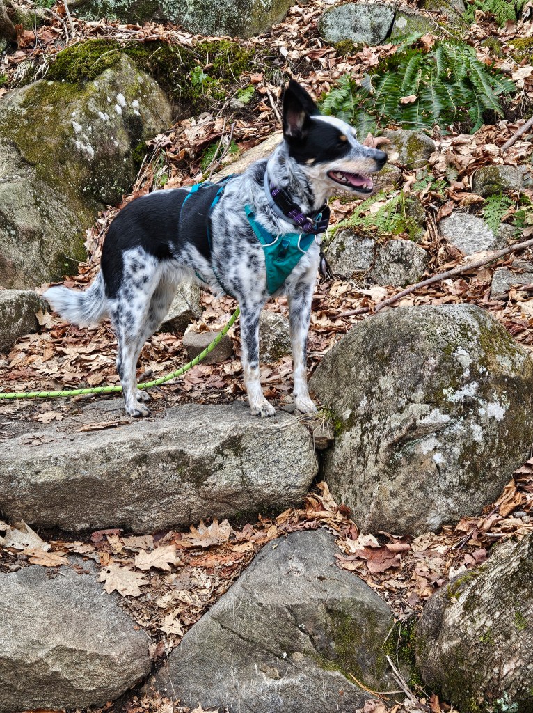
We started with Poke-O-Moonshine Mountain which has some interesting terrain. Mud was actually very minimal for the most part. One small section was completely covered in ice which didn’t deter Tilly, but made me pause and grab my micro-spikes. I probably didn’t need them, but seeing as I lack 4-wheel drive, better safe than sorry.
Tilly handled the bridges and ladders beautifully, it was as if she was never scared of them (her first hike encountering man-made wooden structures was full of terror and resulted in me carrying her over bridges and up steps).
At the top winds were whistling past at roughly 20 miles/hour and Tilly was NOT impressed. She gave me just enough time to locate the surveyor disc and snap a few photos before she started bolting down the mountain. Granted, a lot of her eagerness to trek down the mountain resulted from another hiker descending and her drive to herd him to safety. The concept of “hike your own hike” does NOT apply to Blue Heeler in working mode I guess.
Once down the mountain, Tilly took a 20 minute nap while I drove to Belfry Tower to check the next mountain off my list.
Belfry Mountain is literally a 5 minute walk up mostly a dirt/gravel road. It is well maintained and used for training but a very underwhelming ‘hike’ to be sure. At this point I was hoping to hit Swede Mountain before heading home, but the light drizzle of rain that had started on our descent down Poke-O-Moonshine, turned into a proper rain storm and I could tell Tilly was starting to feel the cold.
Overall my start the the 2025 hiking season was a success and there was a lot less mud than anticipated! I can’t wait to start logging longer miles with Tilly by my side.
Until next time, stay safe out there and leave no trace!
Race Brook Falls and Mount Race
near Sheffield, Massachusetts My first Day Hike of the AT (albeit a very small potion of this hike was actually on the AT) is in the books! I opted to go with a shorter day hike as I wasn’t sure what the terrain in Massachusetts would look like as well as giving myself and Tilly…
Taconic Crest Trail to Snow Hole
Petersburgh, NY Back in the Good Ole’ U S of A! Not gonna lie, I was originally hoping to start my AT day hike this weekend but life and lack of energy caught up with me. After much debate I decided Tilly and I would hike closer to home and attempt one of the Taconic…
The Gobbins Cliff Path
Antrim County, Ireland This was an AMAZING hike full of views and information as it can only be completed by booking a tour. Davy was my tour guide and he was very knowledgeable about the history of the path as well as current efforts to maintain the bridges and landscape surrounding the attraction. Helmets are…
